
Guide · Make It Happen
Legal & Planning Mechanisms
Retrofit Strategies change a street's physical form. That change usually depends on something happening first: land being controlled, a policy being adopted, a classification being changed. This page catalogs the legal and planning tools that make retrofit strategies possible in the first place.
These tools don't specify a design. They specify who controls the ground a design would sit on, or what a jurisdiction has committed itself to doing. A road diet is a design decision. A corridor preservation ordinance is what keeps the right-of-way for that road diet from being built over before anyone gets around to it.
This page is a catalog of the existing menu of tools. See How Road Changes Actually Happen for how these tools typically enter a project's timeline, and Funding & Financing Mechanisms for the related question of how a project actually gets paid for.
Related Media
 Aligned
"You deserve a street that is safe, enjoyable, and pleasant" - Complete Streets in Louisville, KY
 National Complete Streets Coalition
The National Complete Streets Coalition tells the story of Louisville's Complete Streets ordinance, showing how the policy guides city leaders, advocates, and neighbors toward safer streets. It is a concrete example of the Complete Streets policy mechanism the Commonway System lists, treating the ordinance itself as the legal tool.
MED-075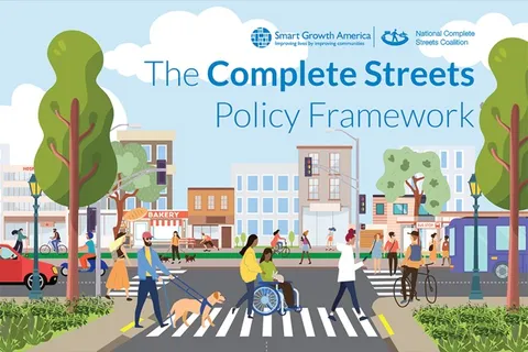 Aligned
Complete Streets Policy Framework
Smart Growth America / National Complete Streets CoalitionThe Coalition's current best-practice guide lays out the 10 elements of a strong Complete Streets policy, from commitment and equity prioritization to design guidance and implementation planning. It is the general reference for the Complete Streets policy mechanism the Commonway System lists, written for any level of government rather than one city's story.
MED-083#Right-of-way control tools
These tools reserve or acquire land for a future transportation use, typically well before construction funding exists.15
#Official map
What it is. A map, adopted by ordinance, that designates the future location of a planned street or right-of-way expansion. Property within the mapped area can be restricted from development that would conflict with the future facility.4
Who controls it. Local government, by ordinance, usually tied to a comprehensive or master plan.
When it's used. Early, well before a project has funding or a design. An official map is a placeholder that prevents the land from being built out of reach.
#Option to purchase
What it is. An agreement giving a public agency the right, but not the obligation, to buy a specific parcel or easement at a later date, at a price set now.2
Who controls it. The agency and the property owner, negotiated individually.
When it's used. When a specific parcel is known to be needed but the agency isn't ready to commit funds yet. Lower-cost than outright acquisition, since it defers payment.
#Comprehensive or master plan corridor designation
What it is. Formally naming a corridor in a jurisdiction's adopted comprehensive plan as a future transportation priority.3
Who controls it. The local legislative body, through the plan adoption process.
When it's used. As the first formal step in corridor preservation, since most other tools in this section reference the comprehensive plan as their legal basis.
#Concurrency ordinance
What it is. A requirement that infrastructure capacity, including transportation capacity, must exist or be committed before new development is approved.
Who controls it. Local government, by ordinance, often required or enabled by state growth management law.
When it's used. To prevent development from outpacing a corridor's planned capacity, indirectly protecting the case for future right-of-way.
#Voluntary developer reservation
What it is. A developer voluntarily sets aside land for a future transportation facility as part of a project, often in exchange for a density bonus or other incentive.
Who controls it. Negotiated between the developer and the local government during project review.
When it's used. When a parcel is being developed before the transportation need is fully funded, and outright dedication isn't legally required.
#Density transfer
What it is. Development rights are shifted from the portion of a parcel needed for a future right-of-way to the remaining buildable portion, so the owner doesn't lose overall development capacity.
Who controls it. Local zoning code, applied parcel by parcel.
When it's used. As a lighter-weight alternative to a full transfer of development rights program, when only a single parcel's right-of-way need is being addressed.
#Setback and building-line reservation
What it is. Zoning or subdivision requirements that keep new construction set back far enough to leave room for a future roadway widening or facility.
Who controls it. Local zoning and subdivision ordinances.
When it's used. Routinely, as a background requirement on any parcel adjacent to a corridor with a known future need, rather than as a standalone action.
#Policy mechanisms
These tools don't reserve land. They commit a jurisdiction to a design approach, which in turn shapes what happens the next time a street is touched.
#Complete Streets policy
What it is. A formal commitment, by ordinance, departmental policy, or executive order, to design and operate streets for all users rather than motor vehicles alone.6910
Who controls it. Varies by form. An ordinance requires legislative action; a departmental policy or executive order can be issued without it, but carries less durable force.
When it's used. As a standing policy rather than a per-project decision, meaning its main effect is on projects that haven't been scoped yet.
#Arterial retrofit ordinance
What it is. An ordinance that specifically mandates retrofit treatment, rather than leaving it discretionary, on arterials meeting defined criteria.
Who controls it. Local or state legislative action, sometimes tied to a state Complete Streets act.
When it's used. Where a jurisdiction wants retrofit to happen on a schedule rather than opportunistically. This is a policy mechanism whose entire purpose is to compel a Retrofit Strategy from the Corridor scale catalog.
#Functional classification reclassification
What it is. Changing a street's official functional class, which in turn changes which design standards and treatments are eligible or required.7
Who controls it. The state DOT or MPO typically holds final authority, though local government can petition for reclassification.
When it's used. When a street's actual function and use no longer match its classification, commonly after a corridor has already transitioned in practice from a through-route to a local destination street or vice versa.
#Context classification
What it is. A design-standards system that ties requirements to the surrounding land use context rather than to functional class alone, letting the same street type receive different treatment in a downtown versus a rural setting.8
Who controls it. State DOT, when adopted as a statewide system; can also be adapted locally.
When it's used. As an alternative or supplement to functional classification, in jurisdictions that have found classification alone too blunt an instrument for context-sensitive design.
#References
- Legal / regulatory Florida Department of Transportation. "What is Corridor Management?" Center for Urban Transportation Research.(opens in new tab)
- Legal / regulatory Salt Lake County Office of Regional Development. "Corridor Preservation Fund."(opens in new tab)
- Precedent-based CONNECT Our Future. "Transportation Corridor Preservation."(opens in new tab)
- Legal / regulatory Utah Code Title 72, Chapter 5, Part 4, Section 403. "Transportation Corridor Preservation Powers."(opens in new tab)
- Legal / regulatory Federal Highway Administration, Office of Real Estate Services. "Corridor Management."(opens in new tab)
- Precedent-based CRTPO. "Complete Streets Policy."(opens in new tab)
- Evidence-based NACTO Urban Street Design Guide. "Functional Classification."(opens in new tab)
- Legal / regulatory Florida Department of Transportation. "Context Classification Guide," October 2024.(opens in new tab)
- Legal / regulatory MRSC. "Complete Streets." Washington state code compilation.(opens in new tab)
- Legal / regulatory Washington Revised Code of Washington 47.04.320-.340. "Complete Streets Act."(opens in new tab)